When the Department of Education declared October 27–30, 2025 as a Wellness Break for students, teachers, and non-teaching staff, I couldn’t help but smile. Finally, a breather we all deserved! And the timing couldn’t have been more perfect. Our family’s long-time German friend, Ate Sabine, had just returned to the Philippines after 11 years, so my younger sister and I decided to spend some time with her and go hiking.
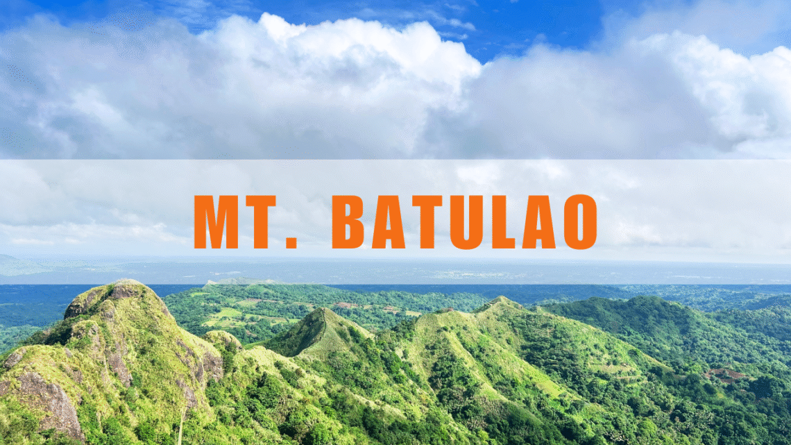
We wanted something nearby but refreshing, and Mt. Batulao immediately came to mind. It’s close, it’s beautiful, and it’s one of those trails that perfectly balance challenge and charm.
The Early Start
On the morning of October 27, we picked up Ate Sabine along with her two companions, Ate Susie and Jannik, from their accommodation. We whispered a short prayer for safety and hit the road at 5:00 AM. It was drizzling when we left Dasmariñas. The last time I hiked Mt. Batulao was in 2017, so I pinned the Mt. Batulao jump-off on Google Maps for directions. The drive to the jump-off point in Arillo (formerly Evercrest Golf Course), Barangay Kaylaway, Nasugbu, Batangas, took about an hour and fifteen minutes. The drive was smooth, except we were a bit confused because there were no clear signs for registration or the parking area. Thankfully, a local guide appeared just in time and led us to the designated parking area. We decided immediately that he would be our guide for the hike.
The Trail Begins
By 6:20 AM, we were geared up and ready to go. The first stretch was a paved path that led us to Mt. Batulao Souvenir Shop and Café. We took a quick bathroom break, grabbed trekking sticks sold for ₱10, and officially began our trail.


Since it had rained the day before, the trail was muddy in parts, but nothing we couldn’t handle.


After around 38 minutes, we reached the first registration area, paid ₱100 each, and continued our way. From there, the trail improved – firmer ground, less mud, and a cool breeze brushing against the trees.


The Crossroad: Old vs. New Trail
About 26 minutes later, we reached the junction that splits the Old Trail and New Trail. Our guide advised us to take the New Trail since the rope section on the Old Trail tends to get slippery after rain. We took his advice and headed for the trail on the right.

The New Trail has “so-called” 12 peaks, each not too far apart. Peaks 1-3 features rolling grassy slopes and shaded parts with a rewarding with panoramic views of Batangas.


After 43 minutes, we reached Peak 4, where a small store sells cold drinks and snacks. We took a break in the nipa hut, enjoyed the trail food we brought, soaked in the view, and had fun with Whitey, the friendly dog who decided to join us along the trail. Carbs, laughter, and a little rest — the perfect mid-hike moment.


Twenty minutes later, we were back on our feet and reached Peak 8 in just eight minutes. This is also the second registration area, where we paid ₱60 each. Our guide explained that the fees help with the mountain’s upkeep, maintenance, and improving the road. I could see the results: the trail was clean and well-kept, and the once long, rough road at the jump-off from my last hike in 2017 is slowly being paved little by little.


Our guide also told us that Peak 8, also called Diana’s Peak, was named after a young woman who tragically fell while taking photos and lost her life on the mountain. She was hiking with friends that day, but they hadn’t hired a guide, and her parents didn’t know she went. It was a quiet, sobering reminder of the importance of hiking safely and following protocols.
Reaching the Summit
We continued past Peaks 9 and 10, then reached Peak 11, where the trail turned steeper and rockier. Thankfully, ropes were in place to help hikers ascend safely.


Finally, at 9:13 AM, after almost three hours of hiking, we reached the summit. We were rewarded with a breathtaking panoramic view of Taal Lake (W), Mt. Maculot (WSW), Balayan Bay (S), Calatagan peninsula (SE), Nasugbu coastline (E), Mt. Talamitam (ENE), Maragondon mountains (N), and Tagaytay highlands (WNW) (Pinoy Mountaineer, 2007). We rested, took photos, chatted with fellow hikers, including a lovely Slovenian family, and sipped fresh buko juice.


The Descent
At 10:00 AM, we began our descent. As expected, going down was quicker. Two hours later, we were back near the jump-off point. The once-muddy trail had dried up, until the sky decided to surprise us again with rain! Good thing I packed my raincoat. We laughed it off and continued walking until we reached the parking area. By 12:30 PM, we were back at the car, just as the downpour intensified.

The Perfect Ending
Before heading home, we stopped by Bulalo Point for a late but hearty lunch. Warm soup, good food, and great company — the perfect way to end our adventure. (We were so hungry, we forgot to take pictures before digging in!)

My last hike was back in February 2024, so this trip felt extra special. I may not be as active these days, but I’m thankful my hiking buddies were just as chill, not in a rush, not chasing records, just appreciating the moment, the laughter, and the beauty of God’s creation all around us.
Reflection 🌿
What I loved most about this hike wasn’t just reaching the summit, it was the journey itself. There was no pressure to move fast, no race against time. We walked, took breaks when we wanted, laughed at our little missteps, soaked in the beauty around us, and simply savored each moment together.
It reminded me that life doesn’t always have to be rushed. Like hiking, each journey has its own pace, and sometimes the best memories are made when we slow down, breathe, and simply be present. Whether on a mountain trail or in our everyday routines, there’s beauty in taking things one step at a time. That simple day in the mountains was a gentle reminder to trust the process, cherish the company, and thank God for every step — muddy, sunny, or steep.


